
Attēls:Map of Argolis.jpg

Sākotnējais fails (5 294 × 3 756 pikseļi, faila izmērs: 14,26 MB, MIME tips: image/jpeg)
| Šis fails ir no Vikikrātuves. Tā apraksts no attēla lapas Vikikrātuvē ir parādīts zemāk. Vikikrātuve ir brīvi licencēta failu krātuve. Tu vari tai palīdzēt. |
| Apraksts |
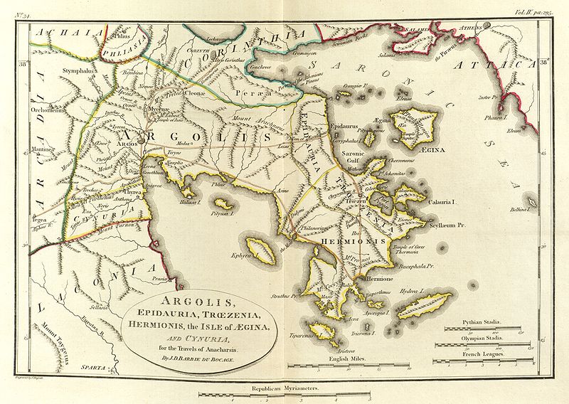
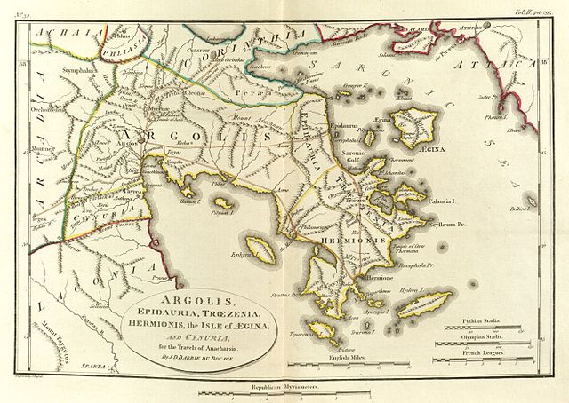
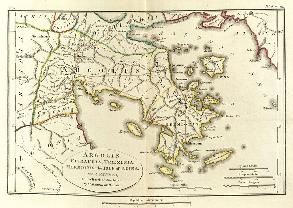
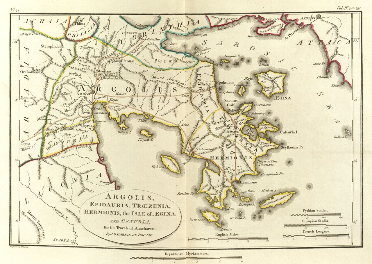
English: Scan of Map of Argolis.
|
|||||||
| Datums | ||||||||
| Avots | Maps, plans, views and coins illustrative of the travels of Anacharsis the Younger in Greece, during the middle of the fourth century before the Christian era | |||||||
| Autors | J. J. Barthélemy | |||||||

Faila hronoloģija
Uzklikšķini uz datums/laiks kolonnā esošās saites, lai apskatītos, kā šis fails izskatījās tad.
| Datums/Laiks | Attēls | Izmēri | Dalībnieks | Komentārs | |
|---|---|---|---|---|---|
| tagadējais | 2010. gada 24. maijs, plkst. 04.27 | | 5 294 × 3 756 (14,26 MB) | Aremulus | {{Information |Description={{en|1=Scan of Map of Argolis. {{PD-1923}} {{PD-self}} {{PD-old}} {{PD-scan}}}} |Source=Maps, plans, views and coins illustrative of the travels of Anacharsis the Younger in Greece, during the middle of the fourth century befor |
Faila lietojums
Šo failu izmanto šajā 1 lapā:
Globālais faila lietojums
Šīs Vikipēdijas izmanto šo failu:
- Izmantojums br.wikipedia.org
- Izmantojums da.wikipedia.org
- Izmantojums el.wikipedia.org
- Izmantojums en.wikipedia.org
- Argolis
- Asine
- Midea (Argolid)
- Lyrceia
- Orneae
- Mases
- Hysiae (Argolis)
- Antheia (Argolis)
- Oenoe (Argolis)
- Elaeus (Argolis)
- Eion (Argolis)
- Cenchreae (Argolis)
- Mount Phoukas
- Neris (Cynuria)
- Eva (Cynuria)
- Araethyrea (Argolis)
- Sphaeria
- Genesium
- Apobathmi
- Lessa (Argolis)
- Prosymna
- Temenium
- Template:AncientArgolis-geo-stub
- Izmantojums it.wikipedia.org
- Izmantojums ka.wikipedia.org
- Izmantojums la.wikipedia.org
- Izmantojums mk.wikipedia.org
- Izmantojums sco.wikipedia.org
- Izmantojums sl.wikipedia.org
- Izmantojums www.wikidata.org